Friday, January 30, 2015

2014 Peak List and Mountain Mileage


Near the Finish- 2014 Salida Run Through Time Marathon
Photo by Maryellen Munday

Most of my time outdoors has been spent hiking, but running was my main mode of "getting out" for most of the year leading up to the Salida Run Through Time trail marathon, held March 15, 2014 .
Running on the summit ridge of 12,208' Mt. Peck
Photo by Maryellen Munday

 In 2013, as we were selling our house and prepping to move from Vermont to Colorado, there was usually time for a run when there wasn't time for a hike. Winter was coming on when we got to Salida, where mild valley weather and a huge trail system near our house made it easy to run all season. With snow in the mountains right outside town, I alternated between snowshoe hiking at 11,000- 12,000 feet, and trail running at 7,000'-9000'.  Although I summited 14er Mt. Elbert on Jan. 18, there were no other peaks for me until June, but I spent the winter getting familiar with all the access points for the high country.


W/SW from Elbert, Castle Peak left and Maroon Bells/Pyramid Peak right.


Sarah T finished the Winter 14ers 1/18/14 on Mt. Elbert. That explained the little party in progress when I arrived.


                 64 climbs of named or Ranked Peaks over 12,000'.


14ers:

-Mt. Elbert (14,433'), 1/18/14
-Mt. Shavano (14,229'), 6 times: June 2&6, July 13 &25, Oct. 24, Nov. 8.
-Mt. Yale (14,196'), Twice: June 18 & 30th (a personal best time 2:25 up/3:55:30 roundtrip).
-Mt. Antero (14,269'), Aug. 6. Finished the Sawatch Range 14ers on this one!
-Mt. Princeton (14,197'), Twice: June 27 & Dec. 12.
-Mt. Sherman (14,036'), Iowa Gulch, Aug. 9 ( a PR of 1:05:01 up, 1:53:34 overall).
-Quandary Peak (14,265'), Dec. 7.

13ers:

-Mt. Ouray (13,971'), Twice: June 24, Oct. 31.
-Esprit Point (13,630'), 3 times: July 13 & 25, Nov. 8. (soft/un-ranked).
-Quail Mtn. (13,461'), July 22.
-Jones Mtn. "B" (13,208'), Twice: July 30, Aug. 31.
-Turner Peak (13,233'), Oct. 29 (w/ Chris Kassar).

12ers:

-Vulcan Mtn. (12,973'), Sept. 13. (soft/unranked).
-Clover Mtn. (12,956'), Twice: July 23, Sept. 13. (soft/unranked).
-Bald Mtn. (12,856'), 5 times: July 20, Aug. 24, Sept. 6, Oct. 4, Oct. 18.
-Point 12,581 (by Cottonwood Pass), 3 times: Aug. 8, Oct. 20 & 25.
-Point 12,565' (by Yale East ridge), Aug. 16.
-Mt. Peck (12,208'), 25 times: July 31, Aug. 2, 12, 21, 27, Sept. 1, 3, 11,23, 24, 26, 27, Oct. 1, 11, 14, 23, 28, Nov. 5, 6, 19, Dec. 2, 11, 18, 28, & 31. (by various routes and as part of loops, etc.)
-Peel Point (12,145'), 4 times: Aug. 2, 12, & 15, Oct. 7.

Alpine Lakes:
-Waterdog Lakes: 23 hikes/runs to one or all 4 lakes, at 11,400'-11,500' elevation, all 4 seasons.
-Hartenstein Lake
-Kroenke Lake
-Monarch (Grassy) Lake
-Ptarmigan Lakes: 3 times

This year's  peak count is a little low for me. Although I put in more miles than ever, there was a lot of peak-less exploring. There were also a lot of trail running miles until August, often without a summit.


The Rundown

I covered 1,623.6 miles in the mountains in 2014, hiking & running combined. Although the two overlap quite a bit, it breaks down to :

*710.7 miles-"Pure Running", from Jan. 1st to August 15th.
      These running miles varied from running the downhills (and some uphill) on several 14ers, to trail runs on the Rainbow Trail, North Cottonwood & Horn Fork Trails, Narrow Gauge Trail, Boss Lake Trail, Salida Mountain Trails system, Continental Divide Trail, Monarch Crest, Colorado Trail, and the "Run Through Time " marathon course.
      Running miles stopped after I tore the knee tissue on Aug. 16th (see below).

* 912.9 miles- Pure Hiking- to all the locations listed, and more, on and off trail. Mostly in Colorado, a few in Utah.

-Marathon Training:
      I ran 1,100 miles in the 12 months preceding the Salida trail marathon. While I was putting in miles back in Vermont I didn't know I was training for a race in Colorado. Over the winter I decided to see if I had another marathon in me- it had been over 30 years, and 20 since my last 10k race. The course had 4,750' of net vertical, much more in true rise & fall, and was all trails, jeep track, and dirt road. I "bonked" pretty hard at 20 miles but finished 126th, 7th in my 50-59 age group, in 5:15:57.
      After, the idea of maybe trying a 50k came & went, and though I kept running, mountain climbing steadily increased as summer came.  

The Unfortunate Knee Incident

On August 16th I was hiking down to Avalanche Gulch trailhead after a day of exploring Mt. Yale's East Ridge and nearby Point 12,505' when there was a sudden, super sharp pain at the lower inner side of my right knee. I slowed way down and hoped it would "smooth out" after a minute. Fortunately it was less than a mile to the car.
 
When I got home it was obviously messed up, and I got it looked at, MRI'ed, and diagnosed as a medial meniscus tear, arthroscopy scheduled for 9/17. In the meantime I kept up hiking gentler terrain, sticking with mellow 12,000' summits along the divide north & south of Monarch Pass, and checking out fall colors at some amazing alpine lakes.

Kroenke Lake, Sept. 16th

Along the way the knee was improving, but didn't feel very strong on steep terrain. A week after arthroscopic surgery the doctor told me to stop running- or at least limit it greatly and DEFINITELY no more marathons- but that I was cleared for unlimited hiking.
      Them's the breaks. After great experiences with running as a teen, in my early 20's, again in my 30's and then in my mid-fifties, it's time to move on. Being able to get into the backcountry is what matters, and I can still hike pretty fast!

 Comparing Some Recent Years:

2013                                                                  2012

1,170.1 miles Overall (hikes & runs).                          1,115.1 miles, all Hiking.
868 miles -Running trails /River Road(dirt)                194 Summits Total:
* 12-  Named or Ranked Peaks                                  * 53- VT 4,000 footers
           over  3,000'  elevation                                       * 57- NH 4,000 footers
* 72- summits of 2,400' Crossett Hill,
   mainly on snowshoes, from our house.                   * 1 - Maine 4,000'
                                                                                       * 83- Other Named
                                                                                                or Ranked  Peaks  
                                                                                                over 3,000' elevation.
                                                                                       (Also 404 miles logging road
                                                                                         trail runs,
                                                                                         brings total to 1,519.1)   

2011                                                                 2010            

920.9 miles, all Hiking.                                              619.4 miles, all Hiking. 
167 Summits Total:                                                    105 Summits Total:
* 39- VT 4k's                                                               * 37- VT 4k's
* 32- NH 4k's                                                               * 14- NH 4k's
* 77- Other Named or Ranked                                  * 45- Other Named or Ranked
New England Peaks over 3,000'.                                  New England Peaks over 3,000'.
* 17- Colorado 14ers                                                   * 8- Colorado 14ers
* 1- Colorado 13er (Sheridan)                                   * 1- Colorado 10k (Hahn's Peak)
*1- Colorado 12er (Galena Mtn.)                                                                                                


2009                                                                 2008

1,008.6 miles, all Hiking.                                            795.9 miles, all Hiking.
168 Summits Total:                                                     149 Summits Total:
* 33- VT 4k's                                                                * 19- VT 4k's
* 79- NH 4k's                                                                * 94- NH 4k's
* 14- Maine 4k's                                                           * 36- Other Named or Ranked Peaks 
* 42- Other Named or Ranked Peaks                                  over 3,000'.
          over 3,000'.

 2007

293.2 miles
Includes:
* The Long Trail from Canada south to Mt. Ellen (4,083'), with however many summits are on that section! ( Looks like 19 peaks over 3,000', including 3 - 4,000 footers).
* 12 other summits in VT & NH, like Mt. Cardigan, Adams & Madison, Mt. Hunger & White Rock, Spruce Mtn., Mt. Jackson, Mt. Tom, Liberty & Flume, with some repeats.

Ancient History

Before 2007, records are scattered through old journals, AMC Hut logs, running logs,  dog-eared & annotated guidebooks, and faded memories. I wish I had documented everything better along the way, like my Winter 1995-"96 Long Trail section transit North from Sherburne Pass to Appalachian Gap.  Of trips here in Colorado in the 70's there only remains whatever old photos friends pull out now & then. These days I try to record at least the basics of date, weather, companions, miles, and anyone met en route. They help with hike planning, and they're really fun to read!  


A lot of 2014's miles passed this spot
The Continental Divide north of Monarch Pass. A nice part of the neighborhood.


Numerous trips out to ranked 12er Bald Mountain
 

Twice up trail-less 13er Mt. Ouray

6 times up 14er Shavano this year

Mt. Antero (14,269') 8/6/14 Sawatch Range 14ers finish
 
 
Good times in the southern Sawatch Range

Wednesday, December 17, 2014

2012 Waterman Fund Essay Contest Entry- Where this blog got it's name

The Laughing Man, a natural feature on "Secret Mountain"

                                    Report from Secret Mountain (3,???’)

            Corridor Monitoring and Preserving the Wild Experience of the Long Trail


            One enchanted summer afternoon, a teen aged boy who was hiking the Long Trail stopped for lunch on a bare little mountaintop. He munched and looked north, up range where he was headed, and wondered how far he might get toward the bigger peaks today. While he had a strong sense of the magic of the mountains, details like the bunchberry blooming at his feet barely registered with him.  He hadn’t seen, either, the bear claw marks on a half-dozen beech trees along the L.T. back at the last “gap”.  Nor did it cross his mind that the treelessness of this lower peak was anything unusual. Focused on moving, it wasn’t long before he finished his peanut butter and honey and hit the trail, never thinking to explore some of the nearby ledges. While he trekked on toward Canada, the roughly crafted stone benches that had been obscured behind some low spruce on those ledges for over a half century looked out to the horizon, alone and unnoticed.  

            The inscrutable course of everything brought me, long after, to live near that same little mountain. It’s a local favorite day hike, and was already part of a circuit of neighborhood hikes I regularly did when I discovered that they needed something called a “corridor monitor” up there.  The idea is similar to being a trail adopter, but not concentrating solely on the trail.  The Long Trail ( like the Appalachian Trail) exists in a “corridor” through a variety of national and state forests, state parks, and private lands where it is protected in an invisible swath, here about 1000 feet on either side, through which the trail passes. A corridor monitor volunteers to walk the boundaries of a section of this strip on a regular basis. They check that the applicable markings, like red or orange paint blazes, are intact.  Good map and compass skills, fine-tuned at a monitoring workshop, help to interpret survey maps and the “BDR” (baseline documentation report) monitors work from. There are tree tags to hang at intervals that differentiate state, GMC, or private lands. These are the most tangible and straightforward tasks. But mainly,  what you are doing is observing.

                 The standardized form monitors fill out after every site visit outlines the day in the woods, with headings like “Boundaries Walked” and “Observations of Wildlife, Plant, Natural or Cultural Resources”.  We’re also noting trail and shelter conditions, though there are adopters who take care of them. We record any wildlife encounters or sign.  Monitors are  on the lookout for any changes in the corridor (like, say, the cutting of an impromptu ATV or ski trail, logging road, etc.) that could affect the protected trail.  We’re just eyes and ears, and the only direct action we take is marking the boundaries and maybe scattering an occasional fire ring.  There is a neat blending of passive and active roles in monitoring; watching the land, maintaining the markings.

            It turns out that these two roles are more integrated than they seem at first. When you go out to spend the day re-marking old blazes, you’re also going out hiking on the trail-less mountainside. There is no footway, even if you can follow the faded paint marks. To see land features best, we try to work in the “shoulder seasons” when the leaves are off, which can mean snow, mud, and ice on the hill.  Secret Mountain’s boundaries had last been painted in 1997 when I took it on in 2007.   Some were still clear, but ten years of blow downs, peeled bark, and fading meant they had to be renewed before they were lost. So I got right on a program of identifying the previously blazed trees and flagging them to return and re-paint. It gave me a chance to get to know the whole “tract”, surrounding about 2.7 miles of trail, while making progress on the vital preservation of survey marks.

            Immersion in a task creates a unique freedom of mind. Up on Secret, I am focused completely on what I’m doing (“Where IS that next blaze on line N 15’31”E ?”). If I were simply hiking up a trail, it would be easier for my thoughts to drift toward stuff in my daily life - but not here. Everything is about opening my senses, peering ahead over my compass for that next old orange axe mark or remnant of flag tape. The terrain is usually steep side hill in moderately dense spruce-fir, sometimes dropping into hardwoods, around huge rock outcrops and boulders, in and out of ravines. The survey line doesn’t allow for topography, so if there’s a cliff in the middle of it, you take a bearing and find a way around to the top. Sometimes light ice or snow will be melting off branches as the day warms up, making for a micro-monsoon in the woods. It can be slow going, but time evaporates. Because I am sort of inhabiting that part of the mountainside for the day, as I go about my business, I start to pick up on some of the little things. That raven, for instance, that wasn’t leaving before me- I was the one being monitored. The super fresh bear tracks in the snow, headed up the cirque in November. The time a barred owl flew out past and landed on a high branch where you never would have seen it. The way robins seem to not mind the cold snowy mountains anymore and exploit high growing sumac berries like crazy! How moose, deer, and rabbit pellets can look mostly the same, just different sizes, and bear scat can look like anything from charcoal briquettes to cow pies, all depending on when and what they’re eating... Traces of the ancient road through the gap…

            Thoreau wrote about something like this in his journals, in his miniature piece “Woodchopper and Scientist”. He called it “relaxed attention”, but he got the idea from Wordsworth’s thoughts on “wise passiveness”. When you’re intent on your work, as the woodsmen were, you’re somehow in a very receptive state for what is happening around you. A naturalist might study particular species and habitats to follow theories, and miss much by preconception and trying too hard. The woodsman just happens to be there all the time, he sees the plants change color and the animals change their coats, while he labors methodically nearby.              

             I learn about a conifer stand where the moose have been browsing heavily, not because I’m looking for that, but because the straight-line easement boundary I’m following happens to run right through there.

            I know that the lean-to on this piece of the Long Trail has a watertight roof. The clouds keep darkening one afternoon while I re-flag the western boundary with my dog. Finally, it turns a weird twilight and I can smell the rain.  We bushwhack east and get into camp just as the storm lets loose with thunder, lightning, and a torrent. It was time for a break anyway. The dog naps while I read the shelter log, snack a little, and doze off a bit myself. An hour and a half later we’re walking out in the drizzly aftermath, satisfied with having accomplished marking about 1500’ of line.

            I find the stone benches one day while scrambling around looking for an opening so that I can see a nearby beaver pond, to check the seasonal level. A rocky area grown over with low spruce hid the way.  The seats are partly moss and lichen covered and look really old.  I start coming out here on my rounds, leaning against the cleverly positioned seat back, wondering who enjoyed this spot enough to build these, and when. Sometime after this, I accidentally discover a very similarly constructed “view seat” near a summit a few miles away, also mossed over and long forgotten. As the “eyes and ears on the ground” of the GMC, I list these finds as cultural resources on my report, along with the surmise that they may have been built by early 20th century L.T. pioneer Prof. Will Monroe and his crew. The Professor was famous for routing the trail past every interesting or scenic spot, so they seem to fit in with his taste - and his vintage. Although it’s usually the natural features of the landscape that grab me, I’m fascinated by the personal stamp on these antique neatly arranged rocks. It shows how attitudes about the land have shifted; it’s not something we would do on a mountaintop today. We’ll probably never know the whole tale, but the air of history surrounding these artifacts adds to the magic on this ridge.

            Like many other trail volunteers, I live reasonably near my assigned area, making it easy to visit it more often than the one or two times per year that we agree to. I thought I was getting out a lot until I heard someone say they had filed 24 reports one year on their section. It can be very satisfying, locating a stretch of boundary and feeling like you’re really getting to know this part of the mountains. Every corner post or axe-blaze discovered is a little mystery solved. There’s also an awareness of taking part in something enduring. You, or someone like you, will be perennially circling, inspecting, and maintaining these borders as long as there’s a trail.  Plus, it’s another excuse to hike.

            Sometimes I approach the easement by bushwhacking up old logging roads, to shorten the distance when I’m working the section far down the L.T. from the day hiker’s trail up the peak. When I reach the corridor boundary, I’m always struck by how far it is from there to the actual trail. These “trail sanctuary” areas can be several hundred to a couple of thousand acres, and sort of constitute little wildland shires, each with their own unique summits, notches, wildlife, ledges, beaver ponds, and waterfalls. I cross this mini-wilderness and, finally, tumble out into the Long Trail itself.

            Maybe the most important reason for maintaining a protective buffer around the trail is that it preserves a hiker’s sensation that they are walking through a “footpath in the wilderness”.  It should give you the feeling that the natural space around you is all that exists. Access to this kind of immersion in nature is a big part of what is being conserved.  

            The teenager on his first thru-hike up the L.T. was living in a somewhat different era than the guy in his 50’s who volunteers on the mountain these days, but they both hiked a Long Trail that is in many ways the same. Sure, some things are a little different up here. The spruce-fir around the summit of Secret Mountain has started to close in the view, as the land slowly recovers from a now centuries old wildfire. There are also more folks out on the trail these days, though it’s still pretty low key north of where the Appalachian Trail turns off. There remains a sense of being on a remote, crag-studded green ridge with peaks pointing off forever to the north and south. Yet this is the same world whose population has almost doubled since that first end-to-end hike.  That you can still climb up here and get this primeval feeling is an amazing and precious thing.  On a long trail, it can be like you’re witnessing the earth as it once was, and feel yourself belonging in it. This is the hidden resource that will always be so essential for people to have access to, this feeling of being completely in the wild. Electricity, cars, laptops, and shopping malls are relatively new to human experience.  To really thrive we need a way to connect to our origins, and a place like a pristine trail can take us there.

             On the Long Trail, any tokens of the faraway industrialized planet usually come up with the hikers themselves. One blue sky day last fall I was trekking back from the gap when I overtook a distance hiker who didn’t seem to hear my hello - then I realized she was using “ear buds”. I managed to not startle her when I passed, and we both smiled. Later it occurred to me that she was hiking with 4 out of 5 senses, with an iPod substituting for one. Like the boy on his long-ago L.T. hike, she might not have quite yet opened up all the way to the entirety of what was around her.  But then, probably after a bit the earphones got put away, and the song of the trail came on.  I expect that before long the sounds of birds, insects, the wind, and her heart pounding as she scrambled up the dome of Secret Mountain were more than enough.

-John Drew Petersen, April 2012

Tuesday, December 16, 2014

A Tale of Three Quandary Climbs

 Sunday, December 7th, I made my third visit to the summit of 14,265' Quandary Peak. Although I usually hike solo, this was the first time on my own for this mountain. The last one was 4 years ago with my wife Maryellen, and before that - almost 36 years ago, when I was 19.                    
 
They don't make 'em like they used to. I still have these 1976 Alfa tour boots.
 
 
Winter 1978-79 I flew back east for Christmas break from Colorado Mountain College/ Leadville, in December 1978. At one of my favorite outdoor shops, Moor & Mountain in Concord, Mass., I found this pair of shearling-lined Alfa XC touring boots for $45. There was just room in my pack for them on the flight back west, where they schussed powder around campus for a few weeks on my new Huski kit-built Nordic skis. Warm!

Sometime in January (or was it February?) of now 1979, a few of us headed out in the pre dawn to go climb Quandary Peak, just over an hour from Leadville near Breckenridge. After a memorable 360 spin-out in a friend's VW "bug" on the snowy roads (car and passengers unharmed), we got to the very buried trailhead. Everyone was on skinny skis, 6 or 8 of us, mostly "light touring" with wood edges- although there may have been a pair or two of the 10th Mtn. type with steel edges screwed to the heavy white wood, and I think one pair of the new Fischer Europa 76 fiberglass/steel edge backcountry models. There was a LOT of fresh powder on the ground when we parked along the road at the trailhead (I don't think there was a parking lot yet).

So much powder that we all skied happily right to the saddle at 13,200', just below the final summit slope of about 1,000'. It was cold, maybe single numbers, with some breeze. Snow stuck to our wool ski pants, hats , and mittens. My feet were getting cold even with the furry lining, but not as cold as some of my friend's were. My roommate Dan & I resorted to the classic mutual-feet-to-abdomen warming technique with mixed results: he got frostbite and I didn't. Guess the shearling helped! We all ditched our skis and headed up.

We were in the clouds on the summit and for much of the climb. I remember seeing the cliffs of North Star Mtn. across Monte Cristo Gulch through the snow filled air and thinking it all looked very alpine. The ski down was a hoot, all the deep fluffy snow making up in fun what we lacked in finesse. The only tracks were ours. There was no one else on the hill.

Mountain goat on Mt. Evans, July 2010
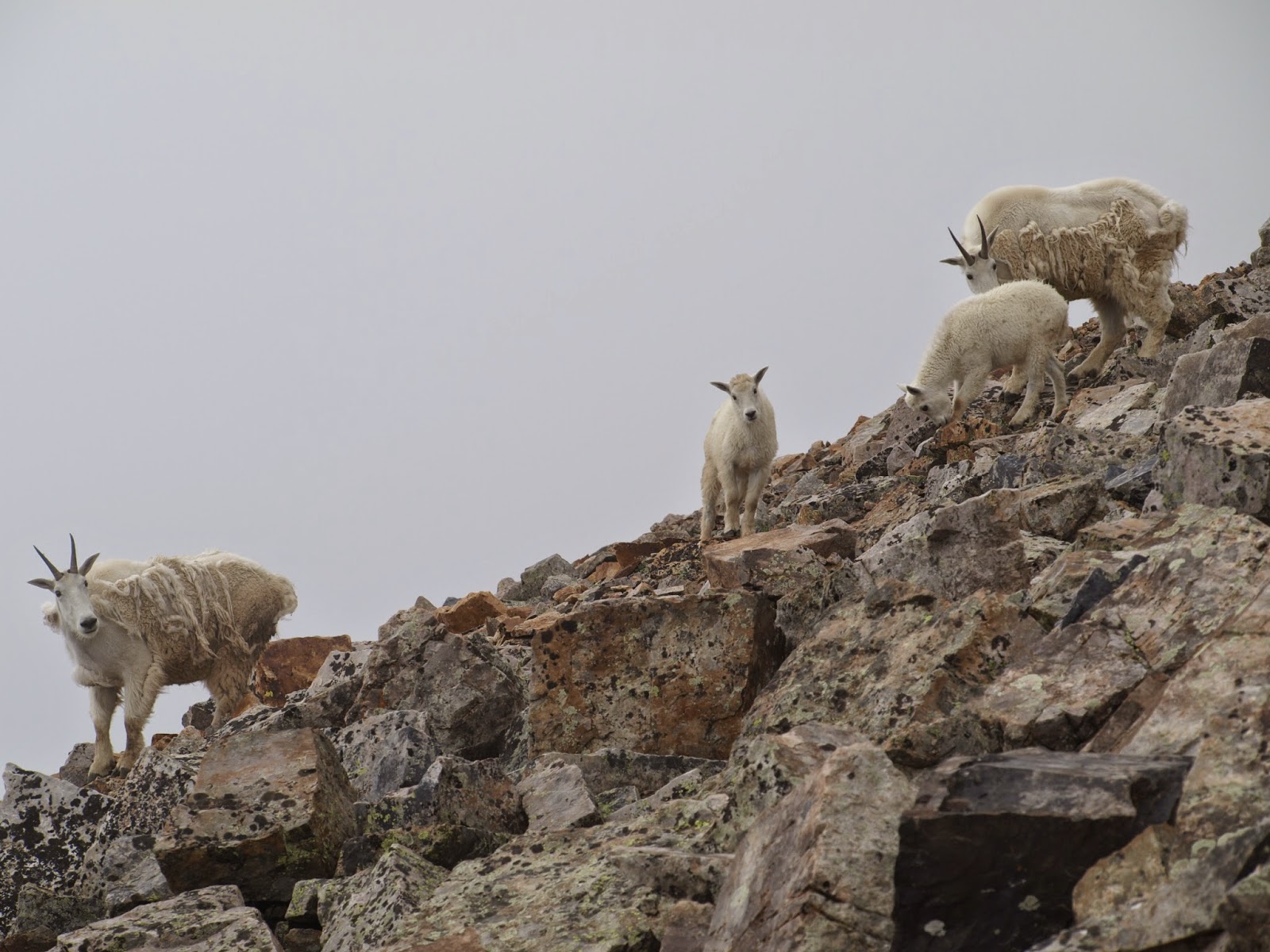
  8/2/2010 -    In the summer of 2010 we made our first trip back to Colorado from where we lived in Vermont. After rambling all over the state , we settled on Quandary for one last hike before heading east. We'd heard that significant numbers of Mountain Goats had moved into the area over the years, and having already seen some on Mt. Evans we wanted more.
On the summit, in the soup
 At around 13,200' on the false summit we had a pow wow. We hadn't seen any goats yet and the mountain was socked in. The altitude was affecting Maryellen enough that we figured she should call it good at the ridge and head back. We used our little walkie-talkies to keep in touch while one went up. and one went down. A short time later some descending hikers said they'd seen some Mountain Goats "by the glacier".  I passed a snowfield, but arrived on top without seeing any goats.
I was happy to see this Pika up there. If he was going to be the only animal I saw today, at least he was friendly.
The West ridge from the summit
The weather was continuing to build toward the forecast afternoon thunderstorm as I started down. Maryellen was still hiking, and I thought I might catch her before she got down (she got there first, and waited 'til I arrived- with the car keys- just before the rain hit- oops!), Ten minutes down the ridge I saw movement just below, to the right.
While focusing on this pair several others started strolling over...
Pretty soon there were about a dozen of these guys grazing tundra nearby. They seemed unconcerned by the people hiking by a few feet away.                                                                   
Except for a wary glance from this one:
They aren't always so docile- on Mt. Massive the following year a poppa goat let me know to stay clear of his little family group. But this day on Quandary they seemed curious, and I was amazed by how close they came if you stood still. 
Eventually they all drifted over the lip, out of sight. as one last sentry kept watch.
I hiked down through a stream of upbound hikers, maybe 50 or 60 altogether. There was a local trail runner who did            
the summit almost daily. There was a middle-aged guy wearing an oxygen mask (I'm serious),             sweating heavily and moving slowly.The experience was so different from our "79 winter                    trip that it seemed like a whole other mountain.                                                                                                                
                                                                                                                              December 7th, 2014 - Late Autumn! 
Last week's early December conditions made for easy foot travel on Quandary. Below treeline, the trail was packed solid- snowshoes stayed in the car, in the Winter parking & overflow lot. Above the trees, everything was windblown, including me since there was a good breeze. There was one climber ahead.  I barebooted right to the saddle, where my microspikes went on just to make it easier on the harder windpack. Much better traction than my Alfa XC touring boots!                                                                                            
Clouds were blowing by, obscuring and revealing nearby peaks. I caught up to the person ahead and walked the last few yards to the top with them. The wind was 30-35 mph on the summit.                                                            
 
Looking into McCullough Gulch from the summit
Bundle Up!
Nary a Mountain Goat to be seen today, but I know they don't mind winter above treeline.
Top of Quandary Peak, 14,265'
I counted 9 hikers, including myself, on the mountain today. Pretty tranquil for a weekend.
Two guys from NYC ditched their skis about where we did in "79.
 
Quandary's reputation as an "easy" fourteener doesn't bother me. It's a beautiful, classy mountain. I 'll be back to climb it again soon.                                                                                                                

Sunday, November 30, 2014

Table Rock, The Hallway, & The Dugout


A flattish boulder bridges rocks to create a small "window",
right on the apex of the NE summit of 12er Mt. Peck,, exactly on the Continental Divide.


Pikes Peak through the "window"


Uncompahgre Peak, west through the window, directly over the stone "gnomon".
 
The small opening makes it easier to see detail at a specific point. This would be useful for spotting smoke signals or firelight from predetermined locations. I call this a "View Guide".                         
    It's probable that the "table rock" that creates this portal got there by geologic means. It isn't so big, however, that it couldn't have been levered into place by several determined individuals.                   
This is just one of a number of unusual stone features on Mt. Peck that we'll get into in another post.
 
 
The Hallway at "The Dugout"
A few miles north on the Divide is a complex I call "The Dugout". It's a good place to escape the wind on an otherwise exposed ridgeline. I have no way of knowing, but it has the look of a natural place adapted for human shelter and utility. It is very near the Monarch Game Drive area.


The other side of "The Dugout", looking over the top of the Hallway.              
The combination of this depression and the Hallway are suggestive of a ruined habitation. At least I've taken shelter there!


If you look up from the Hallway, there is a small "View Guide" at the top of a rough stair:
Uncompahgre Peak thru the View Guide


I've noticed several of these peek-through rock openings along this section of ridge. they all look to the east, west, or both- but not north or south along the ridge. Although they could be naturally occurring, the context of nearby documented ruins increases the possibility that they are human created. The prehistoric telegraph?
View guide at the top of the Hallway wall

Wednesday, November 26, 2014

Game Runs, Signal Fires & Sight Lines

In 1978, on our 12-day Mountain Orientation course at Colorado Mountain College, our professor (Jim Campbell) showed us some low stone walls on a ridgeline, similar to these pictured. He explained how these were remnants of a "Game Drive", which ancient people used to guide Elk to "ambush pits" as part of seasonal meat gathering. The one shown here is right on the CDT, south of Monarch Pass, at about 12,000'- that's 12,856' Bald Mountain in the background.
        There are all kinds of assemblages scattered around. Long term camps were established up here in the temperate part of the year, first to repair and upgrade the drive network, then to harvest & process the meat.  
 This is all pretty well known and documented. The "Monarch Pass Game Drive" was used from about 3,000 B.C. to the early 1800's, when native contact with whites occurred.  There are even some interpretive signs at the site, a surprise the first time I hiked through here.
 It covers a large area of grassy ridge, and it's easy to imagine the whole operation in action. I met some elk hunters up there this fall not far away. I guess some things haven't changed.
Once you know what you're looking for, you start to develop an eye for the difference between this stuff and 1800's mining ruins. For one thing the bases are deeply pressed into the ground.  The zig-zag lines of wall segments stand out against the tundra, and the terrain has natural features that would help channel big herds of big animals.                         
Here's a much more eroded short wall segment on the bushwhack up Bald Mtn.
 There are numerous artifacts along the ridge, including some ancient firepits.
Yup, this actually compares to authenticated, dated stone-lined firepits in the nearby upper Gunnison Basin. (Hunter-Gatherer Archaeology of the Colorado High Country,  University Press of Colorado, Stiger 2001) It's totally unexcavated, off-trail, and I don't know if anyone has noticed it before. What's really interesting about this one is that it's perched right on a cliff edge.                                            
 Looking West from the firepit, clear line-of-sight to 14er Uncompahgre Peak in the San Juan range.
                               To the east, a sightline to Pike's Peak, in the Front Range.
                               Hiking along the ridge among all this archaic infrastructure, my imagination runs wild. What if there was a long-range communication system in place, by signal fires, for thousands of years in the Rocky Mountains?